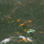
Our Fairbanks map shows there are currently 20,874 active gold mining claims, and 5,438 abandoned claims located on state lands. This map shows gold mining activity in Alaska’s famous Klondike region and is the largest of the four maps that make up Alaska.
- When you first open our Fairbanks gold map you can see the yellow and blue clusters of gold claims throughout the area. The yellow clusters reveal where others are finding gold today. The blue clusters of abandoned claims don’t necessarily mean there’s no gold there—it could mean there just wasn’t enough gold there for a large mining company.
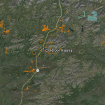
- There’s one camp site for RV’s and tents in Coldfoot but it’s too expensive for our money—and we don’t want to drive to our site every day. If we’re mining up here we’d prefer to wake up on-site every morning. There’s fuel and a small medical facility in Coldfoot but bring everything else you’ll need. Be sure to include some guns as there are bears—and a fly-rod because the trout fishing is world-class.
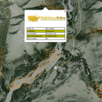
- Zoom in further still and click on any claim for contact information. Take the owners name and MTRS value to the Alaska Department of Mineral Resources for contact info if you want to lease a claim. But to be honest, there is a lot of rich road-accessible unclaimed creek beds around this area because many prospectors think “it’s just too far north.” It’s not…
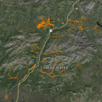
- Now take the Dalton Highway north out of Fairbanks to a small town called Coldfoot Alaska (Ice Road Truckers™?). You are now in the Koyukuk-Nolan mining district and about 45 miles north of the Arctic Circle. There is a huge amount of placer mining in this area and it’s crisscrossed with old mining roads that can get you to a new site, or to a claim you’re leasing for the season.
Fairbanks Gold Mining Notes: None of the images above show just how close you can zoom in and see potential prospecting sites. You’ll be amazed at how crisp the satellite imagery is and how much exploring and planning you can do from the comfort of your home.


